Rising Currents: A New Urban Ground

As sea levels and storm surges rise, A New Urban Ground unites ecology and infrastructure to preserve and enhance life in Manhattan.

images
lower Manhattan with proposed landscape buffer

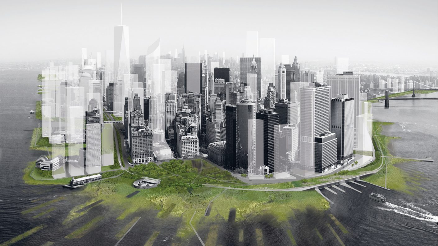
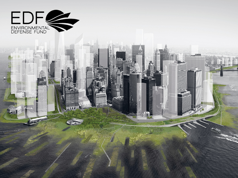
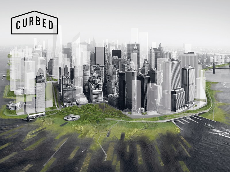
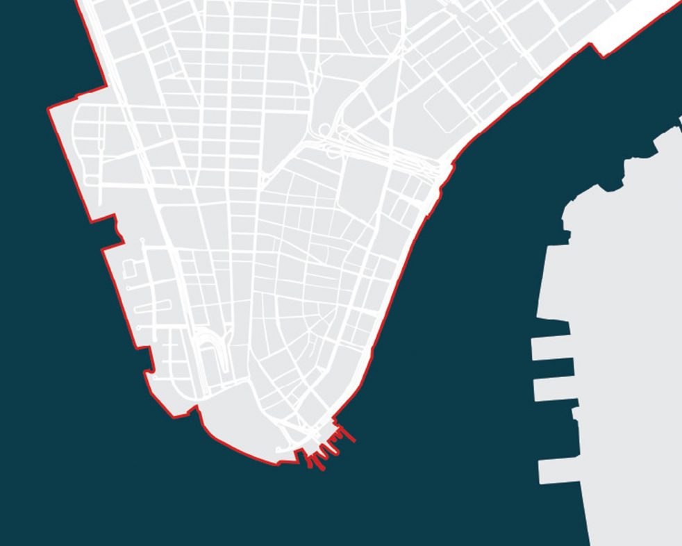
Low-lying and densely inhabited, Lower Manhattan sits in the path of any storm surge. After a two-year investigation of New York’s Palisade Bay—funded by the AIA’s 2007 Latrobe Prize—we were invited by the Museum of Modern Art to address this challenge with a contribution to their 2010 exhibition “Rising Currents: Projects for New York’s Waterfront.” The exhibition presented the work of five design teams who each reinvented sites throughout New York City. Our two-part proposal with landscape firm DLANDstudio creates a new paradigm for ecology within the city that not only protects Lower Manhattan from rising waters but also enriches day-to-day life.

images
  • proposed lower manhattan master plan with landscape infrastructure
  • 2010 existing sea wall around lower manhattan
  • category 2 storm inundation mapped onto Lower Manhattan
  • combined sewer overflows mapped onto lower manhattan
  • water interchange in lower manhattan
images
section cut of proposed urban estuaries
The west side of Manhattan is defined by a crenulated pattern of urban estuaries and city fabric.

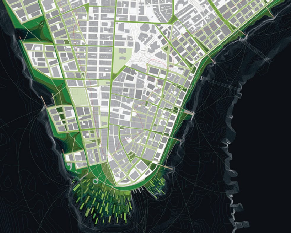
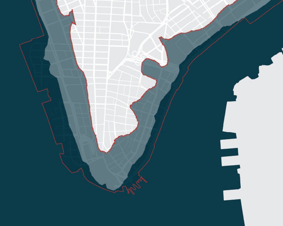
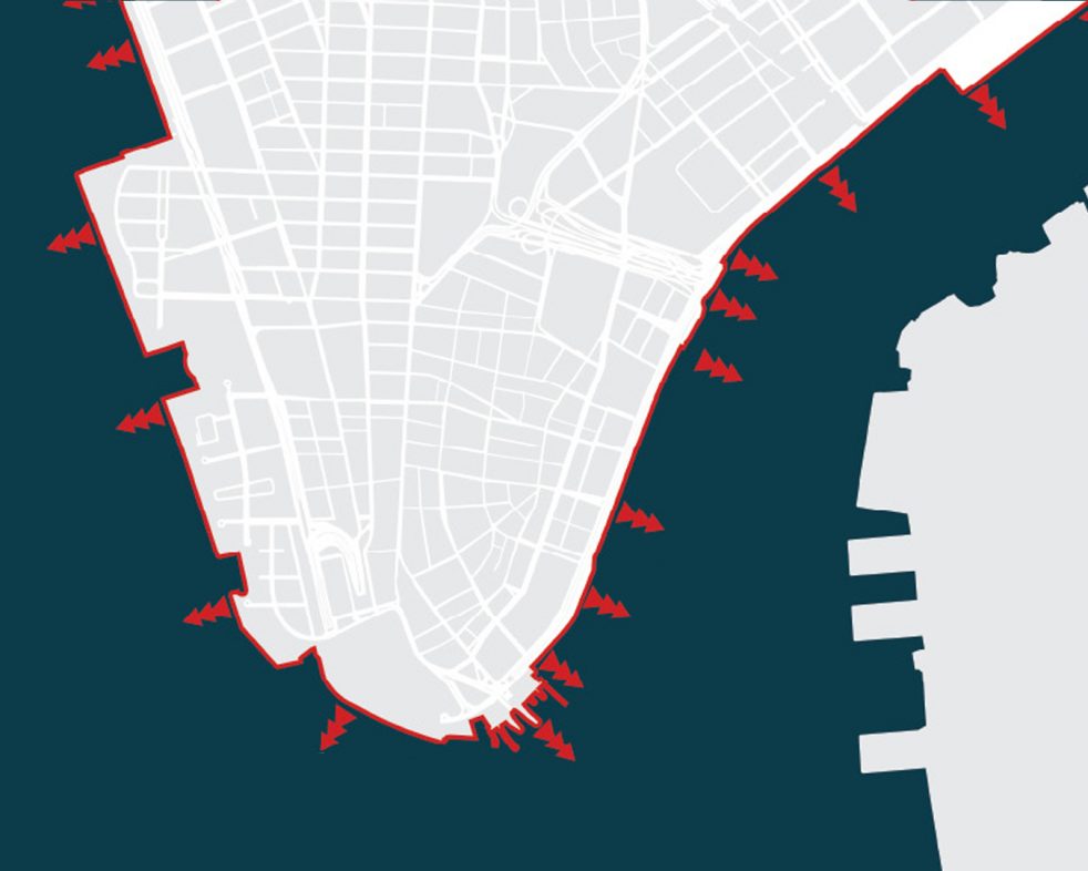
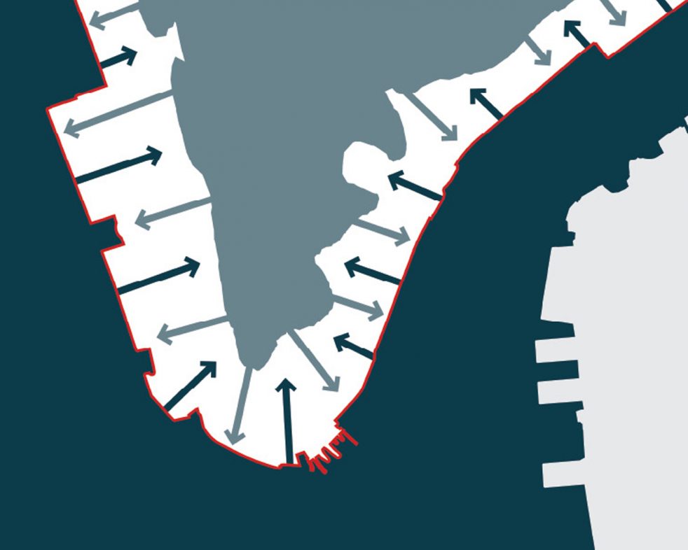
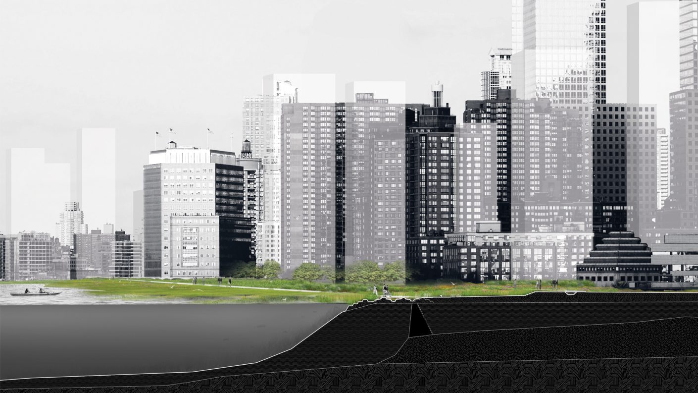
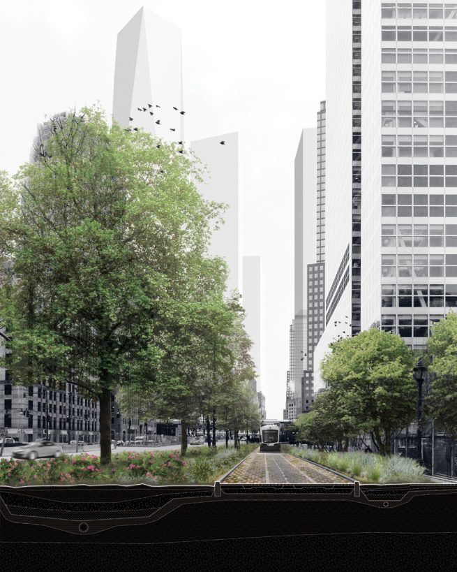
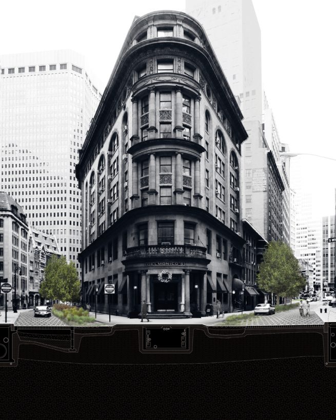
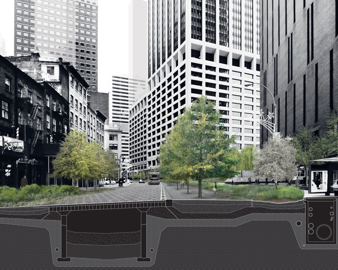
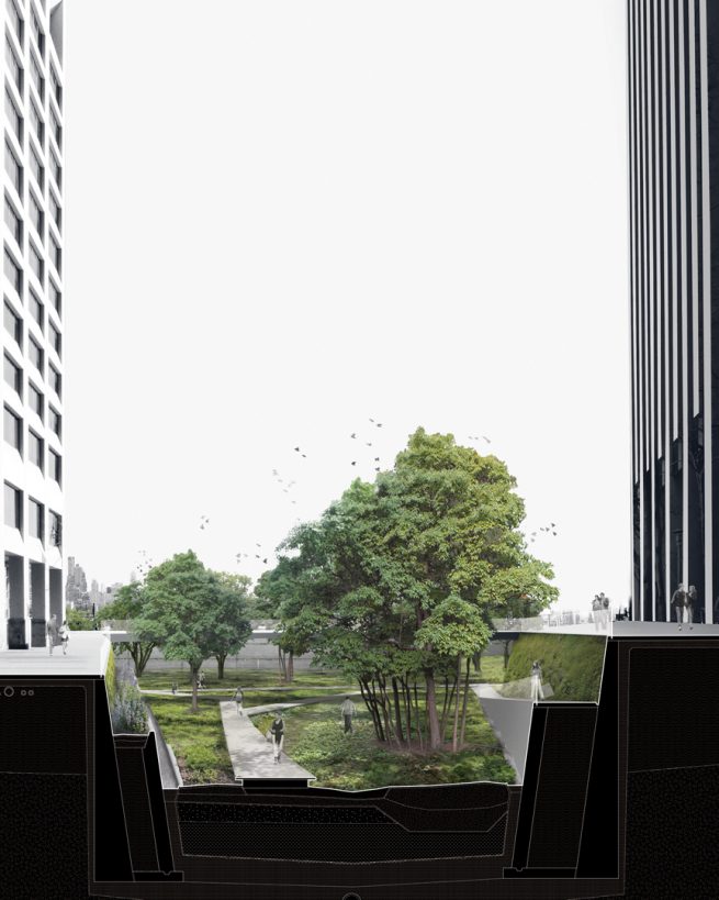
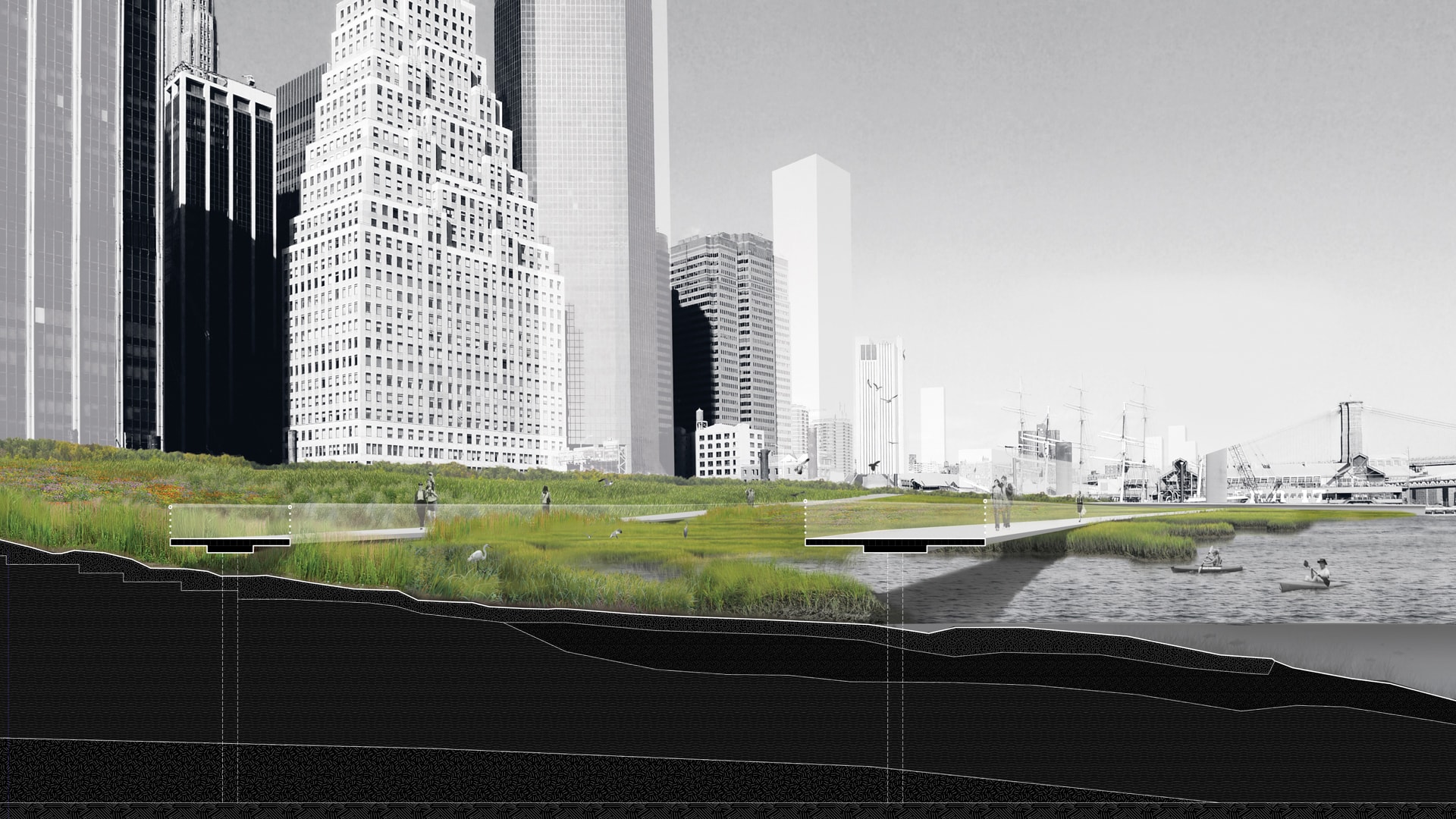
The proposal consists of two basic components that form an interconnected system: porous green streets and a graduated edge. Porous green streets create a network of absorptive surfaces for excess water and provide much-needed park space in a famously dense district. On the edge of the island, three interrelated high-performance systems block higher sea levels and mitigate storm surges: a productive park network, freshwater wetlands, and tidal salt marshes. Together, these interventions build upon existing systems to create a new ecological infrastructure to support our city.

images
section of proposed Western Parkway
West Street is reconstructed and renamed Western Parkway for its green space, a light rail transit loop, pedestrian walkways, and bike paths.
images
section of proposed Hanover Square intervention
Hanover Square: within the area affected by a Category 2 hurricane, the roadbed is rebuilt as a network of porous green streets to absorb rainfall and channel storm surge inundation out to the harbor.
images
section of proposed Water Street intervention
Water Street runs parallel to the shoreline and is designed to hold storm-surge volume and drain back to the harbor.
images
section of proposed Coenties Slip
Coenties Slip: A linear forest below street level runs along the East River to the Brooklyn Bridge, providing a first line of defense against storm surges.
images
section of proposed Lower East Side landfill
The east side of Lower Manhattan is extended with landfill by one block to create an esker, or ridge, parallel to the shoreline.

Read more about the research that informed “Rising Currents” in Stephen Cassell and Adam Yarinsky’s article for Places Journal.

Press
Rendering of Rising Currents, ARO's proposal for green infrastructure for Lower Manhattan
Rising Currents on the Cover of EDF’s Solutions
Rising Currents in Curbed